Planning for a First Trip to the Cirque of the Towers
I know a few people headed to the Winds for the first time, and found myself repeating advice and thought it might be better written down and shared. If you're making your first trip to the Cirque of the Towers hopefully you find this helpful.
Getting There
There are a few routes from Salt Lake City, and they all require quite a bit of driving on dirt roads. Cell service gets spotty after Evanston, so have the route mapped out and stick to it. Don't expect many services except a gas station or two unless you swing up to Pinedale, which is slightly out of the way.
The dirt roads can lull you into a false sense of security before whipping a hairpin turn at you out of nowhere, so keep an eye out for that. Most passenger cars should be able to make it to the Big Sandy Trailhead, but there can be some big rocks poking out of the road so take your time.
The parking lot at the trailhead always seems to be full. I like to pull up and drop my bags off, then drive out to the overflow lot you see as you pull in (aka a big field). It adds a half mile or so (I can't remember exactly).
The Approach
The trail to the Cirque is well traveled and pretty straightforward. If I remember correctly, all major trail junctions have signs. Expect it to be flat-ish until Big Sandy Lake, where you will lose most of the backpackers and hikers. Then the trail gets steep, then flat, then steep, then flat, etc until you get past Jackass Pass. If you are a strong hiker it goes pretty quick and the scenery is great.
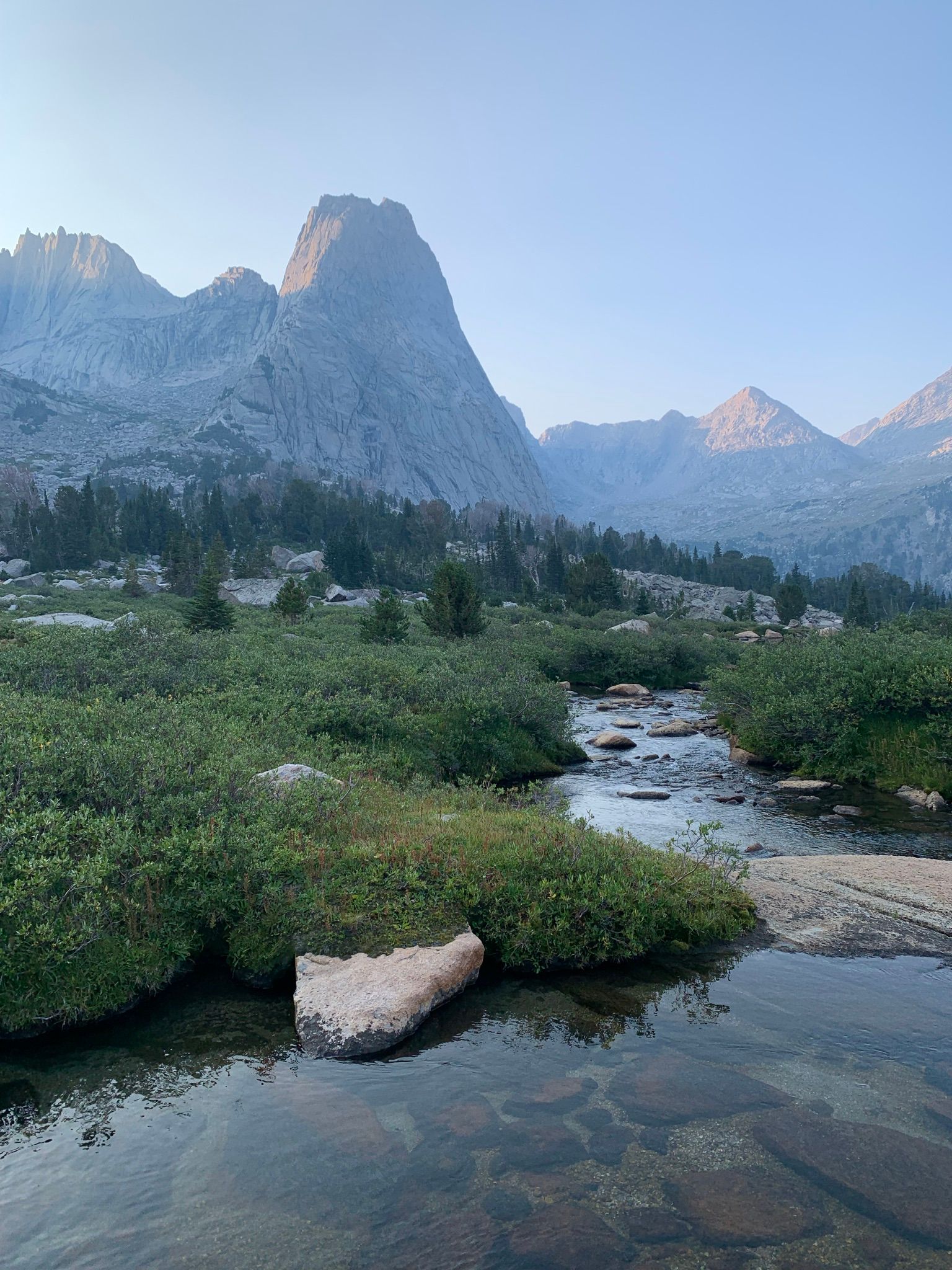
The Cirque
The cirque itself can be relatively crowded for a remote wilderness area. The Forest Service has not been able to keep up with the increase in usage and you will find many threaded trails wandering around the cirque. Despite your best efforts, it will be hard to stay on "the" trail, if there even is one. Do your best to minimize new trails and campsites, and please please take wag bags and pack out your poo. Most climbers filter water from the streams passing most of the campsites into Lonesome Lake (in the middle of the cirque due south of Pingora). Another good reason not to poop in the ground.
Most areas of the Winds have monstrous mosquitos in early-mid summer, be prepared with DEET and/or headnets and make sure you have any holes in your tent netting patched up (Lone Pine Gear does great work).
The area is known for afternoon thunderstorms, which can be hard to see coming in from the west. Do your best to start early or be prepared for inclement weather. A weather forecast is not good for very long.
Climbing
Expect the classic routes to be busy, especially on a weekend. There are several alternative climbs, but they can get crowded as well in the 5.6-5.8 range. Make sure to pack plenty of water, or start early enough to be the first team on it. Not everyone will willingly let you pass on routes like this. If you really are fast enough, some routes on Pingora have variations and alternate starts.
The East Face (5.7) and Northeast Face (5.8+) of Pingora are both long and committing routes. There is no easy way down once you start up, you will have to leave gear, or cross the East Ledges route near the summit and downclimb it (5.2). It may be worthwhile to climb K-cracks (5.8) route first so you can scope out the descent. There is a dedicated rap station to the climber's left of the K-cracks, followed by a scramble off the south shoulder of Pingora. Onsighting in the dark may not be fun. I personally found the climbing on the K-cracks route to be about on par with the climbing on the Northeast Face, so it could be a good warmup for those concerned about the grade.
Don't be afraid to rope up for the grassy ledges ascent to Wolf's Head, and be prepared to inspect and replace webbing on the rappels on the way down. Rockfall broke a piece of tat on a rap station two summers ago and a climber died, so don't trust your life to some crusty ass webbing without thinking about it.
Safety
Don't forget your headlamp, epic-ing can be made worse by having to navigate with your dying cell phone. Study those topos ahead of time, especially if you plan on being the first on the route. Going up a conga line and route finding up a huge face with no one in front of you are very different experiences for the budding alpinist. There are some great photos on SuperTopo and on Mountain Project.
Cell service is non existent in the Cirque or anywhere nearby. The local SAR team for Sublette County does perform rescues and does have a helicopter, but it is not the Wasatch or the Front Range. You will not be whisked off a cliffside. Take an inReach or other device to be able to communicate emergencies. Be prepared to self rescue and get yourself down. Calls for rescue late in the day will likely not be answered till the following day. Helicopters also do not like to fly in high winds, so keep that in mind if the forecast is not great.
The climbing and rock are generally very good and clean on the classics, but be aware of large loose rocks. Blocks the size of a car can and do move.
Most of all, have fun!!